
Five years ago the Galwan Valley was in the News for the wrong reasons after a deadly clash between the Indian and Chinese Armies in the Valley located in Ladakh lead to many deaths on the contentious Border between the two countries in wake of continued Chinese intrusions into Indian territory.
This area along the Shyok River, of which the Galwan Nallah or the Galwan River which forms the Galwan Valley has been off limits to Civilians since long but now the Indian Government has decided to open up the area for Civilians and we were amongst the First Civilians to venture into this beautifully desolate part of the Eastern Karakorams in Ladakh. Earlier Civilians could only venture upto the Village of Shyok from where the Shyok River takes a U turn and flows in a Northerly direction.
Read More
A holiday in Kashmir involves much travelling around by car from Srinagar (not only the capital but the base of most visitors), a shikara ride, walking around markets and the Old City – a heritage site in its own right. That’s all very well, but it is convenient to know where you can grab a bite, preferably in the area where you are seeing the sights.
Read More
A Photo Gallery of Keran along the Line of Control in Jammu and Kashmir
Read More
Most People while visiting Ladakh just visit the same old Places, popular Tourist places and ones popularized by Bollywood and Influencers on Social Media. As a result a few Places bear the brunt of the Tourist footfalls which has serious Environmental and Social Impact.
I have always subscribed to the Philosophy that instead of sending 100 people to 5 places send 20 people to 25 places. Ecologically viable Tourism starts by spreading the load of the Tourists. And here is a list of Ten Things that I would recommend to do in Ladakh. And please remember that Ladakh is a large Region and most of it is rather unknown for most people. Ive added a Note on the Mountain Geography of Ladakh for easier understanding. You can also read my Ladakh Travel Guide for General Information.
So I have compiled a list of Ten Things that I would do in Ladakh, keeping in view all my Visits and Readings on Ladakh. They are in no particular order and each One is a Unique experience in its own.
Read More
The Kaobal Gali stands at an Elevation of 4167 metres (app 13600 ft) on the main Great Himalayan Range has traditionally connected the Tulail and Gurez Valleys with the Mushkoh Valley in the Drass Region. Interestingly people on both sides of the Pass are Shina and speak Shina language just like their fellow Dardic Shina people in Gilgit. This is a peculiarity as usually when you cross a Pass on the Great Himalayan Range the Culture Language and People change.
Read More
Most People while visiting Ladakh just visit the same old Places, popular Tourist places and ones popularized by Bollywood and Influencers on Social Media. As a result a few Places bear the brunt of the Tourist footfalls which has serious Environmental and Social Impact.
I have always subscribed to the Philosophy that instead of sending 100 people to 5 places send 20 people to 25 places. Ecologically viable Tourism starts by spreading the load of the Tourists. And here is a list of Ten Things that I would recommend to do in Ladakh. And please remember that Ladakh is a large Region and most of it is rather unknown for most people. Ive added a Note on the Mountain Geography of Ladakh for easier understanding. You can also read my Ladakh Travel Guide for General Information.
So I have compiled a list of Ten Things that I would do in Ladakh, keeping in view all my Visits and Readings on Ladakh. They are in no particular order and each One is a Unique experience in its own.
Read More
Most people are eternally confused about the location of the LoC in Kashmir. And Tourists are shown the LoC from almost everywhere. Even the Pahalgam side.
Anyways this is a simple Map which explains the LoC in Kashmir.

Once the Expedition commenced there arose new Challenges. Though the Afghanistan Civil War had ended, the situation in North Afghanistan and Routes into the Pamirs were far from being safe for the Expedition. So another detour was decided. It was decided that the Expedition would now crossover into India from Afghanistan and then they would take the Mountain track that connected Srinagar in Kashmir with Yarkand / Tashkurgan in Chinese Turkestan or what is now Xinjiang
Read More
One of the relatively unknown areas of Kashmir with vast tourism potential is the Valley of Bangus. Lying within the Trans Himalayan Area, Bangus is a unique combination of ecological area, compromising Mountain Biome, which includes Grassland Biome with flora at lower altitudes, and Taiga or Coniferous forest.
Read More
Gurez is a Valley in the north of Kashmir. It stretches from a short way above Gurais Fort to below Sirdari. The main road, leading from Kashmir into the Valley, crosses the Rajdihgan Pass ; the distance from Bandipura, at the head of the Wular lake, to Kanzalwan, on the left bank of the Kishanganga, being about 25 miles, which is usually divided into three stages. The entrance to the valley is exceedingly picturesque, as the river comes dashing along through a rich meadow, partly covered with lindens, walnut, mud willow trees, while the mountains on either side present nothing but a succession of most abrupt precipices, end alpine ledges, covered with fir trees. It is nowhere above a mile in width, and is surrounded on every side by lofty peaks, chiefly of mountain limestone, rising far above the limit of forest which covers their lower slopes.
Read More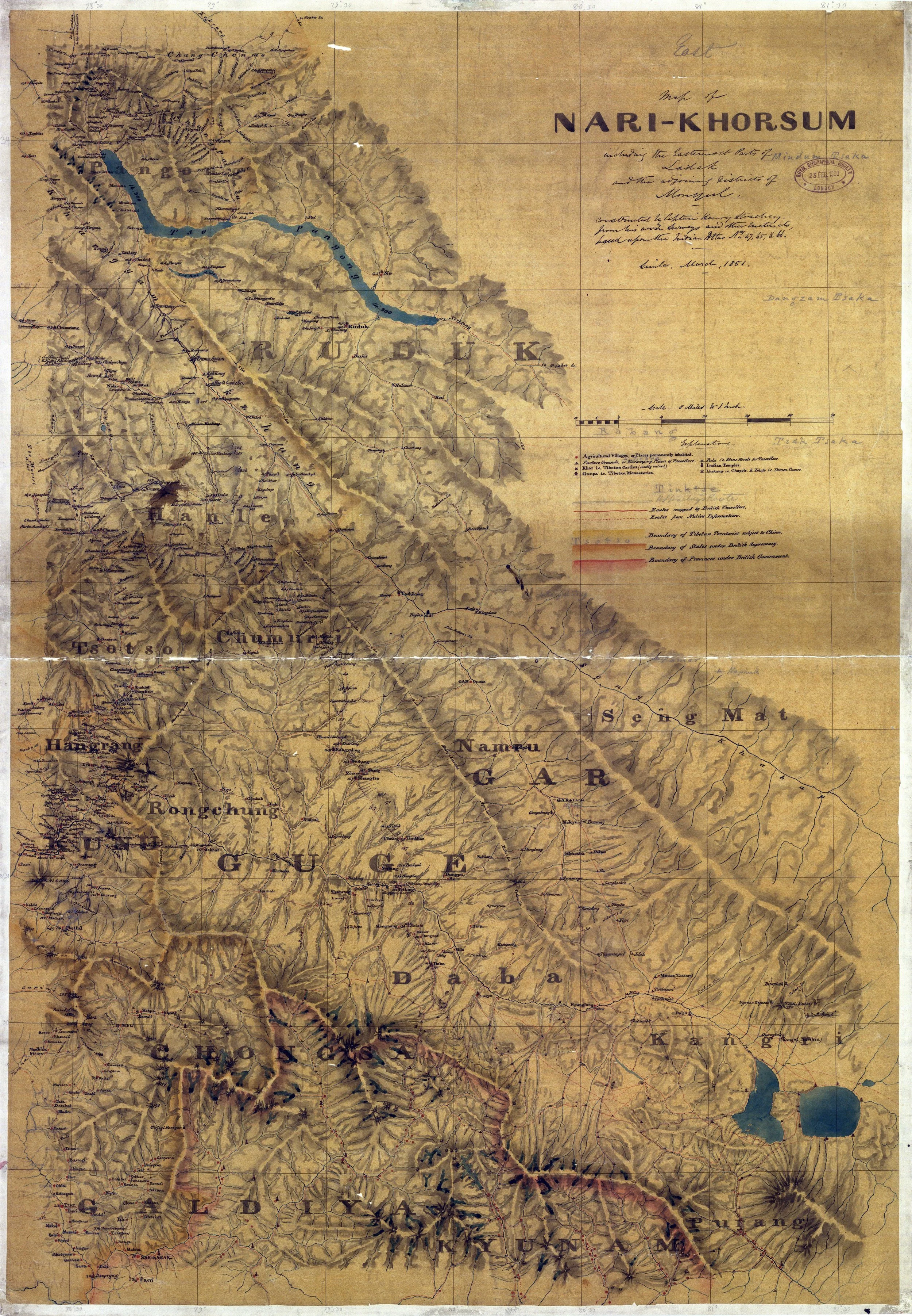
Col Starchey was an Officer in the British Army and was involved in the Surveying and Mapping the unmapped Regions to the North of the Great Himalayan Range as well as around Tibet. He made various Journey’s to the Region and came up with some Great Maps of the area and one of the most prominent being the Maps of Ladakh (Western Tibet as it was called) and the Regions around it.
Read More
But as the Weather Readings below will testify the Monsoon is not consistent over the Himalayas. Different areas in the Himalayas get different amounts of Rainfall during the Monsoons. And the Monsoons are not the only Rainy Season in the Western Himalayas. There is another Rainy Season which arrives in December and it comes in the form of what we call Western Disturbances which are Rain bearing Clouds rising above the Mediterranean and making its way to the Western Himalayas.
Read More
A Rough Guide for People planning to visit the Kashmir Valley. And notes on the History, Culture and most importantly the Geography of the Region. And taking you beyond the normal Tourist Hotspots into more Offbeat and even unheard of places in Kashmir.
Read More
Kishtwar itself is remote and always under the shadow of Kashmir but this part of Kishtwar which lies next to Kashmir on one side and the Suru Valley of Ladakh on the other side is probably one of the last great wildernesses in the Inner Himalayas. This is the Warwan- Marwah - Dachchan belt lies along the Maru Wadwan River or as its also known Warwan / Marwah (Marev) / Marsu Dhar River along different parts of its course, which is a major tributary of the Chenab.
Read More
The Kishanganga is the main River flowing through the enchanting Gurez Valley rising in the Kishansar Lake (which is a part of the Group of Lakes commonly referred to as the Great Lakes) and flowing through some great Mountain scenery until its confluence with the Jhelum around Muzaffarabad in Pakistani held Kashmir. The River was renamed as the Neelam in Pakistan in the 1950s. Old Maps and Books still refer to it as the Kishanganga.
Read More
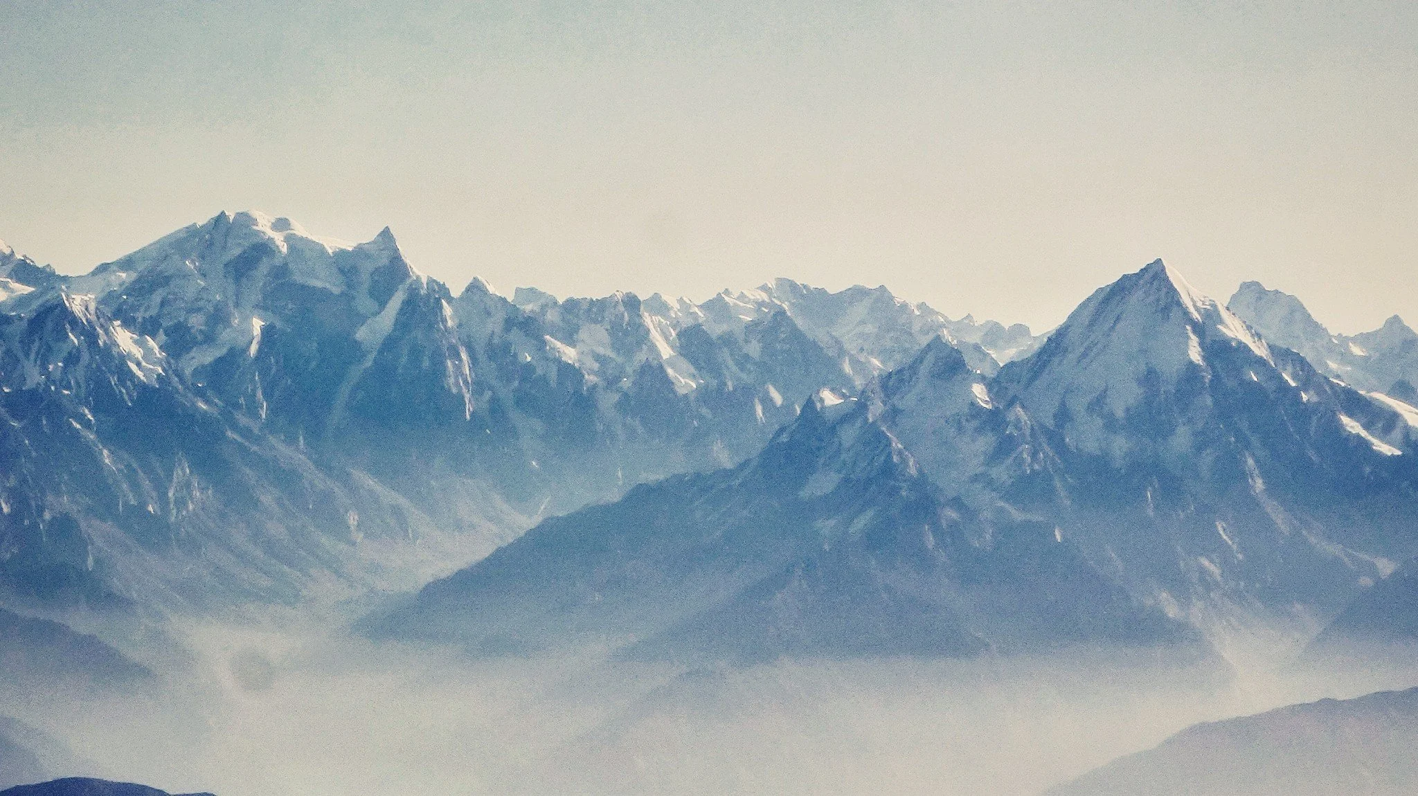
The Himalayas might be the highest Range in the World but when it comes to sheer perpendicularity nothing compares to the mighty Karakorams. Many people consider the Karakoram to be a part of the Himalayas but its not. Its a separate Range in its own right. It might be considered at a part of the Great Himalayan Complex of Mountains that radiate out of the Pamir Knot. In common parlance the term Karakoram is synonymous with its most famous Peak, the K2 or the Godwin Austen as it was once called. But other Peaks and parts of it are relatively unknown.
Read More